GuideBoundaries
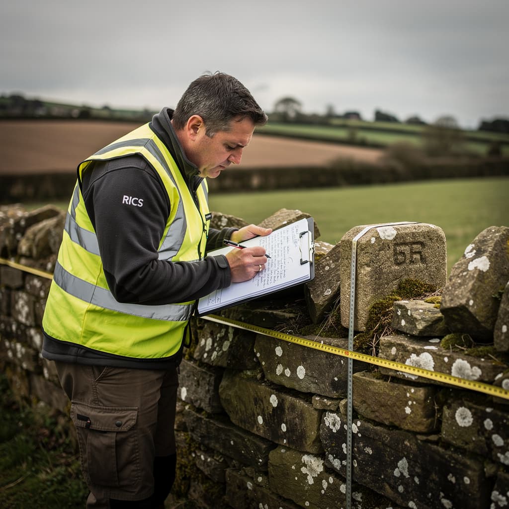
Understanding Boundary Disputes
A practical guide to boundary disputes: what causes them, how they're resolved, and when professional surveying can help.
8 min readRead
Practical guides, example plans, and documentation to help you understand our surveying services and make informed decisions about your project.
Evergreen reference material on surveying, boundaries, and land registration
A practical guide to boundary disputes: what causes them, how they're resolved, and when professional surveying can help.

A practical guide to Land Registry compliant plans: what's required, common reasons for rejection, and how to get it right first time.
A practical guide to transferring part of a property: what's involved, what plans you need, and how to avoid problems with registration.
A practical guide to topographical surveys: what they measure, when you need one, and how the data supports design, planning, and construction.

A practical guide to measured building surveys: what they capture, when you need one, and how the data supports design, planning, and property transactions.
Insights and perspectives on the surveying and cartography profession
In an age of automated tools and self-service platforms, some work still requires professional judgment. Land surveying is one of them.

A cartographer's guide to understanding what your title plan actually shows — and what it doesn't.

How modern digital mapping transforms estate and farm management — from paper records to living documents.
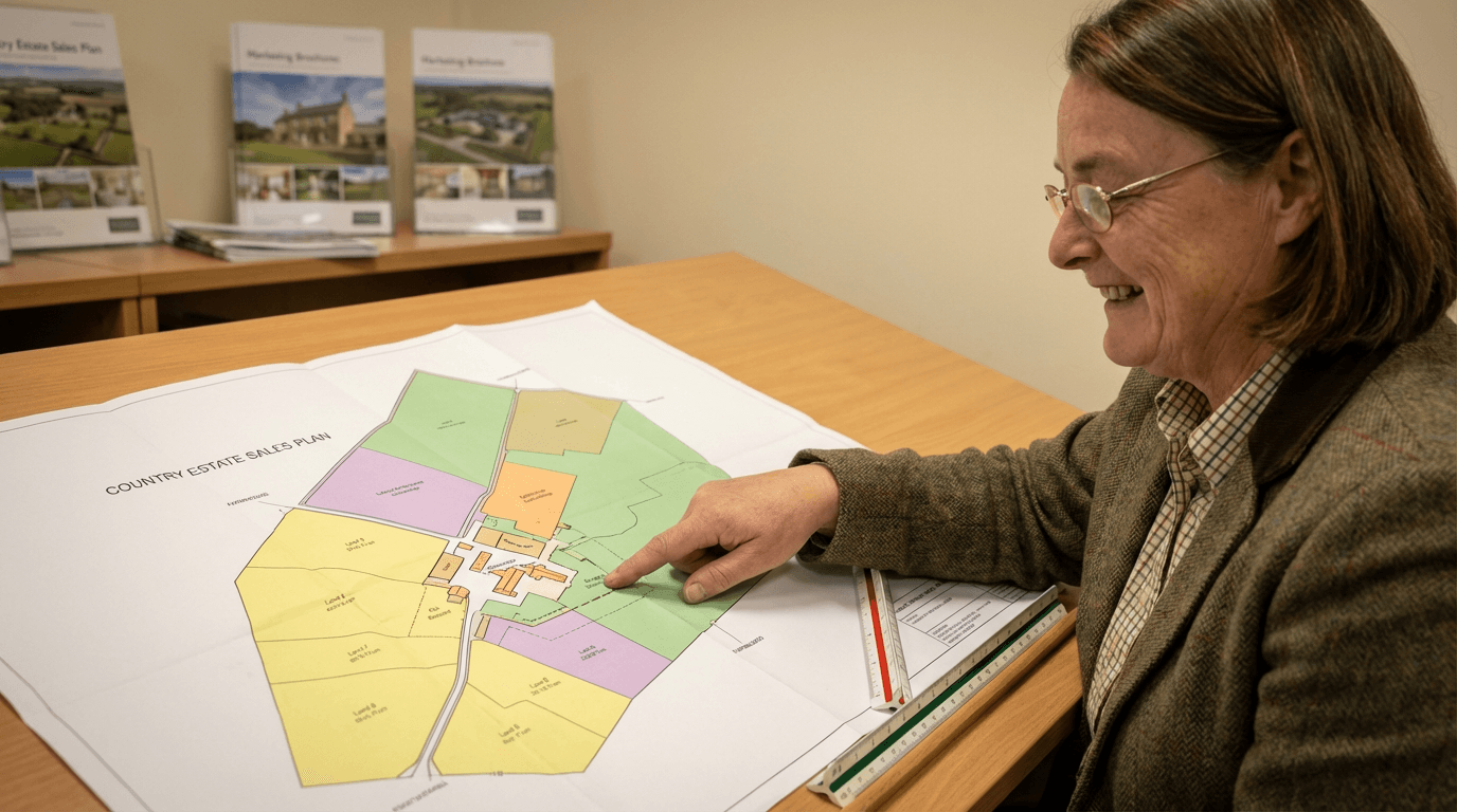
What makes property marketing plans work — and why they matter more than most people think.
Click any preview to view the full PDF, or use the download button to save a copy.
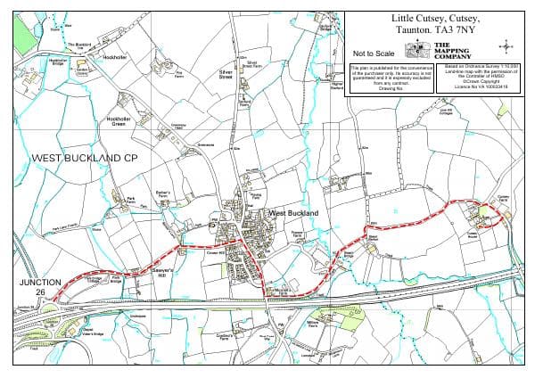
A detailed location map showing our office at Little Cutsey, near Taunton in Somerset. Includes nearby villages and major routes from Junction 26 of the M5.

An example of our detailed 1:2,500 scale mapping, showing Church Farm with individual land parcels, areas in hectares and acres, and OS base mapping.
Related Services
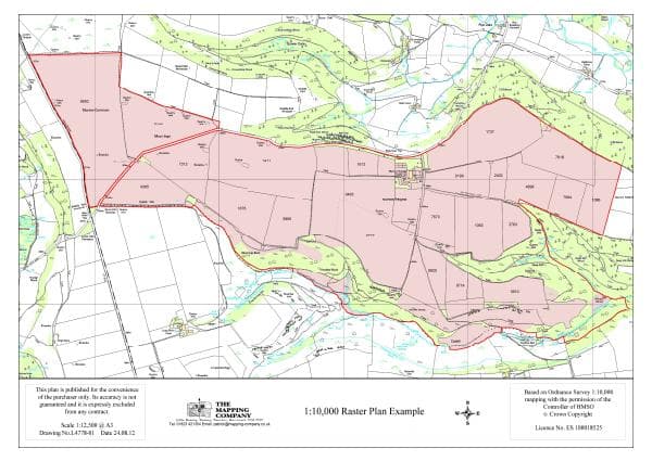
A 1:10,000 scale raster plan example ideal for large estates and farms. Shows property boundaries, field parcels, and topographic features across an extensive area.
Related Services
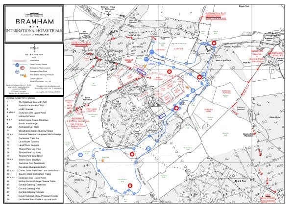
Bramham International Horse Trials cross-country course map. Demonstrates our capability for complex event mapping with numbered obstacles, routes, and facility locations.
Related Services
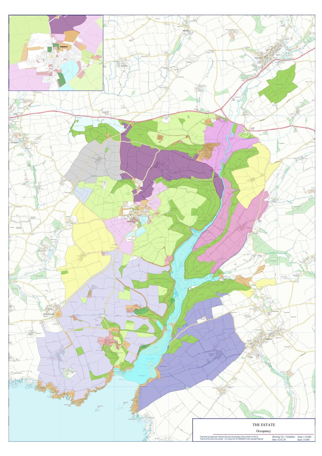
An overview plan illustrating the extent of an estate and how land is occupied and used, including individual tenancies and functional areas. Typically presented on 1:10,000 mapping to give clear strategic context while remaining legible and uncluttered.
Related Services
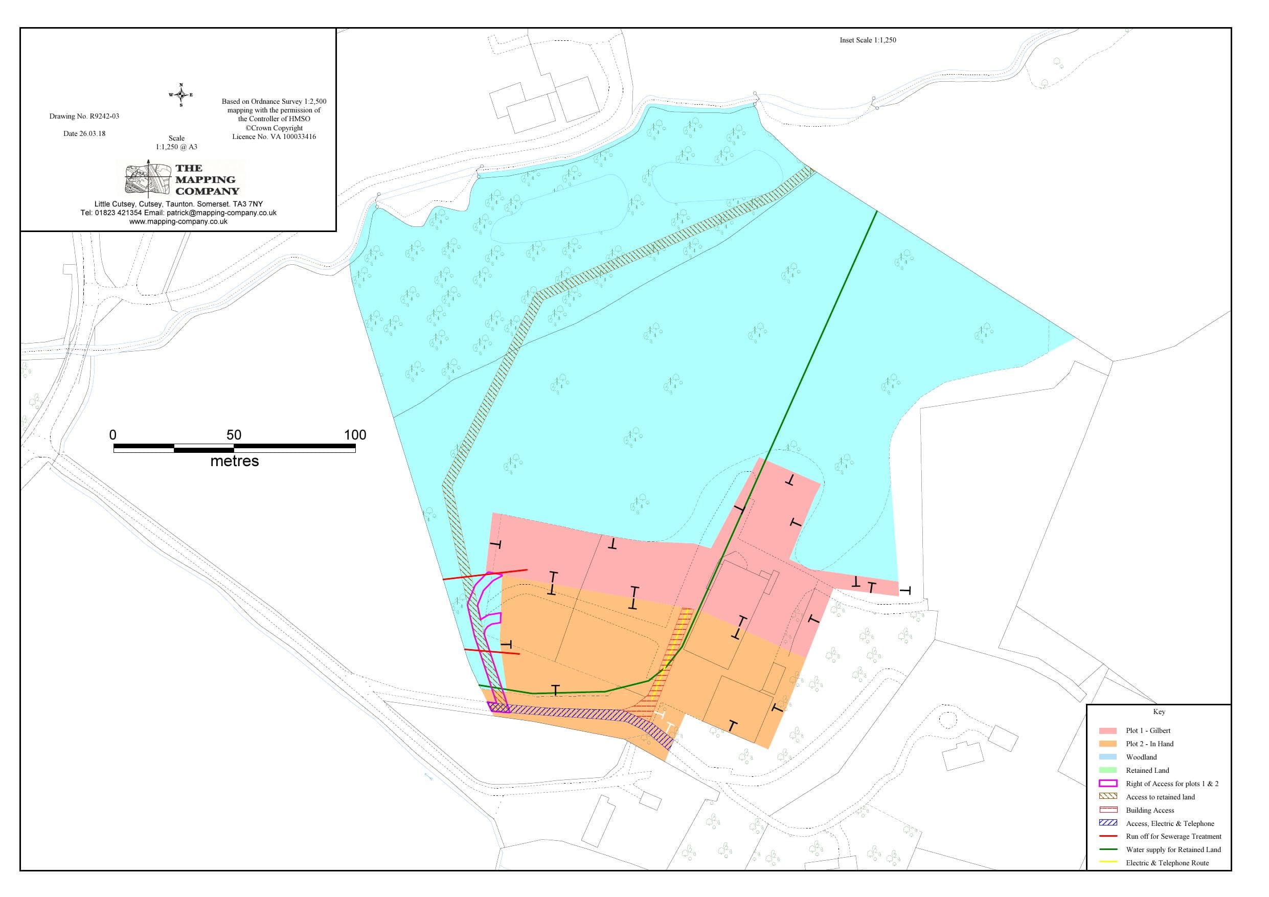
An example plan prepared to meet HM Land Registry requirements, clearly defining property boundaries, rights, and retained land on an Ordnance Survey base. Designed for registration purposes, it is accurately scaled, clearly annotated, and suitable for use in legal conveyancing.
Related Services
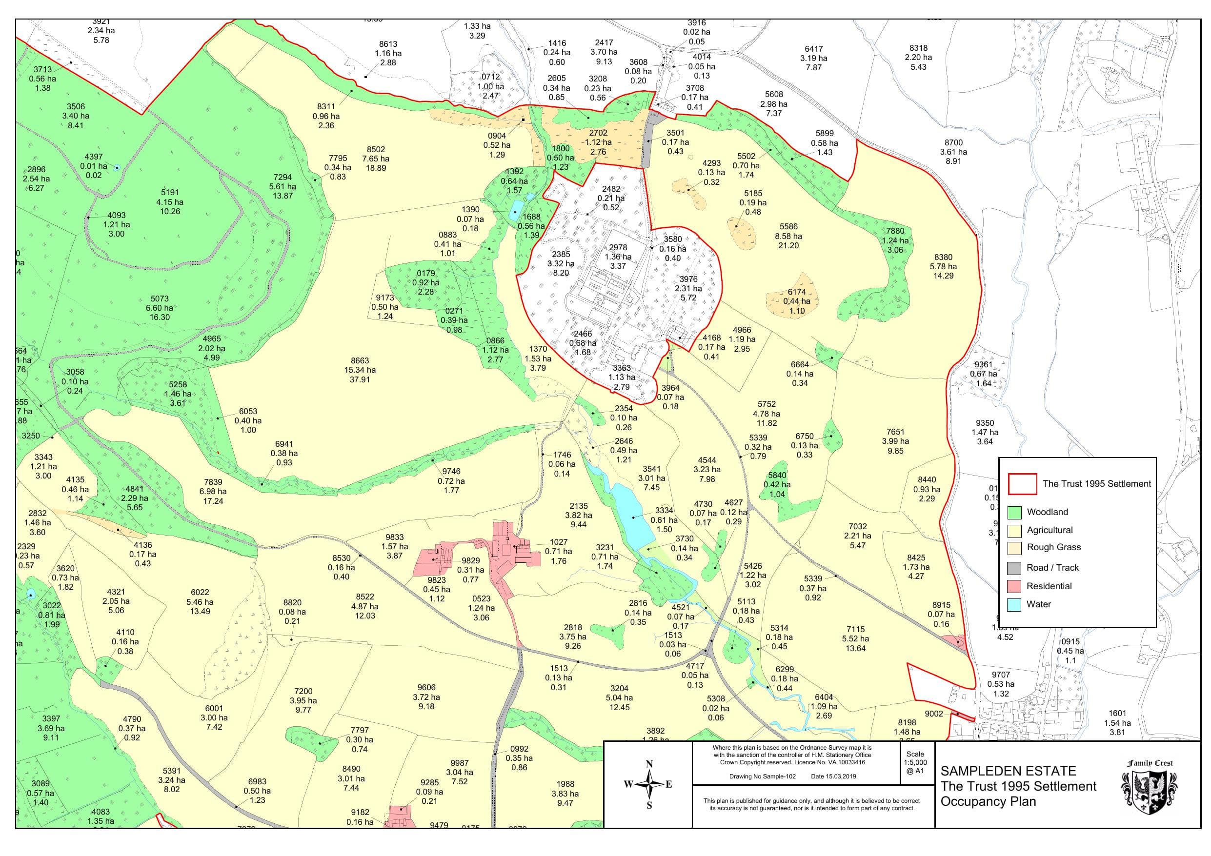
A clear overview plan showing estate ownership and how land is used across the holding, including woodland, agricultural land, rough grass, and residential areas. Designed to provide an at-a-glance understanding of how the estate is structured and managed.
Related Services
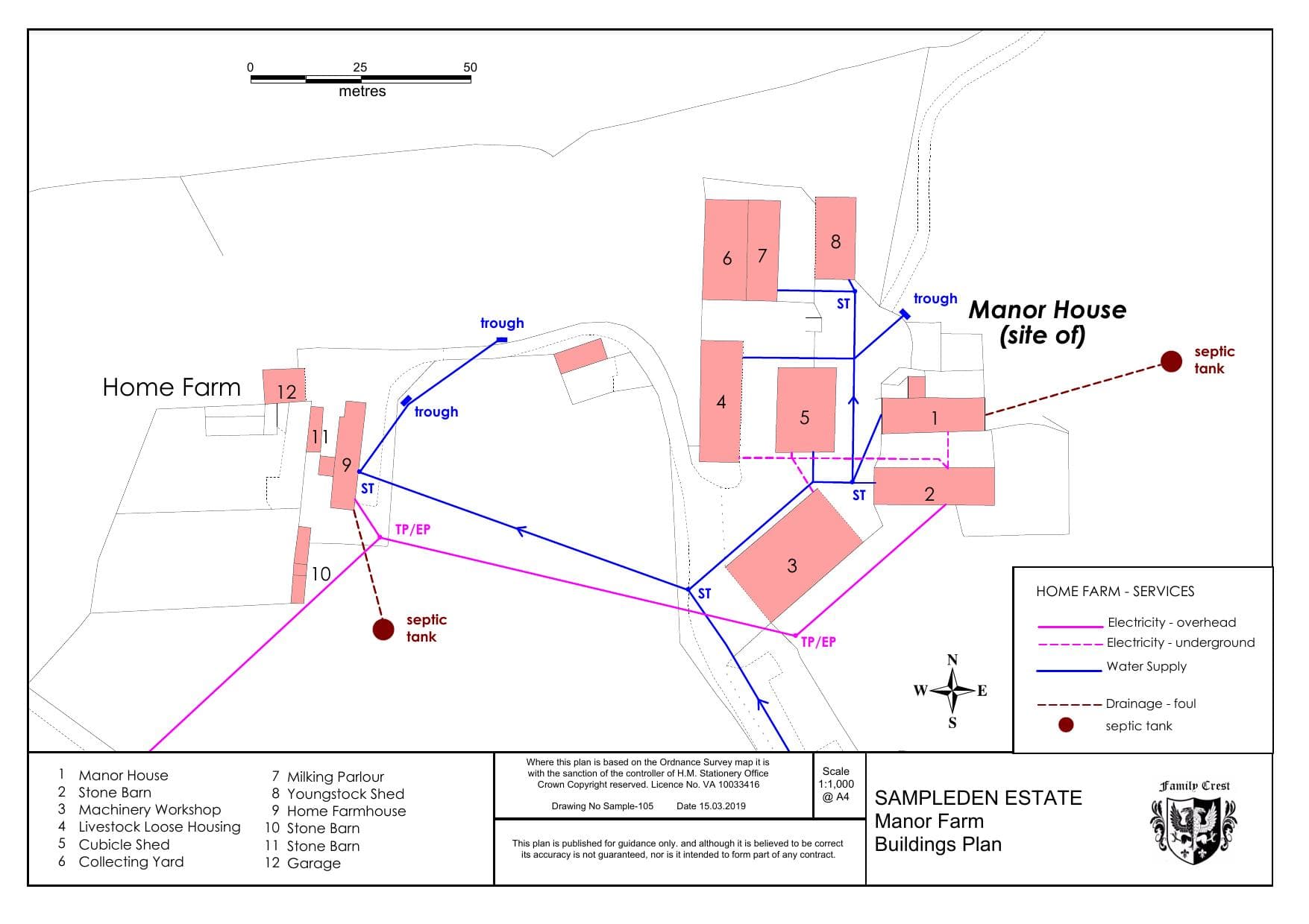
A detailed building plan illustrating the routes and locations of key services, including water supply, foul drainage, and electricity. Used to clearly record service connections for management, maintenance, and legal reference.
Related Services
Real projects, real results
Case studies coming soon. We're documenting some of our most interesting projects to share with you.
These examples represent just a fraction of what we can produce. Contact us to discuss your specific requirements and receive a tailored quote.