
Our Services

Comprehensive surveying and mapping services backed by RICS-chartered expertise and over 30 years of precision measurement. From Land Registry plans to boundary disputes, we deliver the authoritative data your project demands.

Land Registry Plans

Land Registry Plans

HM Land Registry compliant

We prepare clear, accurate, and fully compliant plans for submission to HM Land Registry. Our plans are produced in accordance with the Land Registry's published standards and are suitable for title registration, transfers of part, leases, and first registrations. Whether the work can be completed from existing mapping data or requires a measured survey, we ensure every plan meets the accuracy and clarity needed to avoid delays or rejections.

Desktop-based plans are typically delivered within 24 hours. We also offer cross-referencing against title — available for both digital plans and office copy paper titles — to identify any discrepancies before submission.

What We Offer

1

Desktop-Based Compliant Plans

Plans produced directly from Ordnance Survey MasterMap at appropriate scales (1:500, 1:1,250, or 1:2,500). Each plan is checked for compliance with Land Registry guidance, showing boundaries, access, and orientation clearly for registration.

2

Leasehold Plans

Accurate lease plans for new or existing leases, showing demised areas, shared spaces, and access routes. Where necessary, we undertake a measured survey to ensure internal layouts are represented correctly.

3

Complex Splits & Title Subdivisions

Specialist mapping for splitting existing titles or dealing with complex scenarios such as flying freeholds, retained access, or shared rights. We work closely with solicitors to ensure every retained and transferred area is clearly defined.

4

Surveying New Boundaries

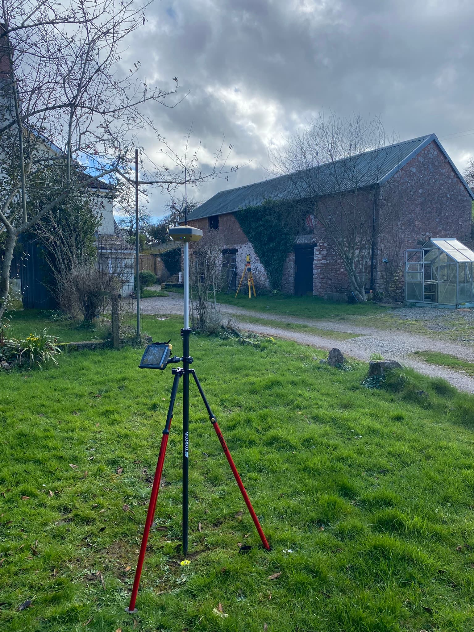
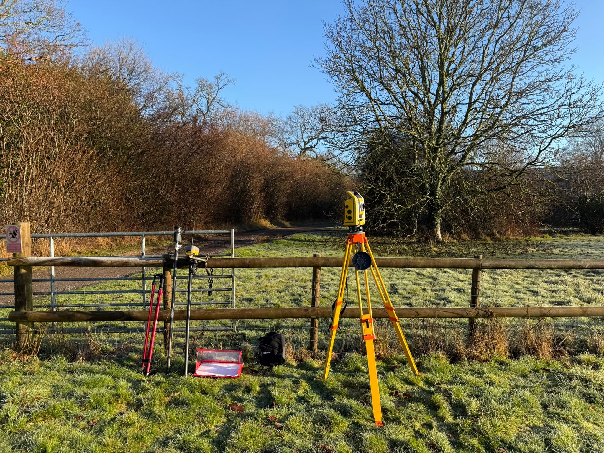
When new boundaries are being created, for example, when selling part of a property or forming new plots, we carry out precise measured surveys using GPS or total station equipment to ensure the plan reflects what will exist on the ground.

Ideal for

  • Title registration
  • Transfers of part
  • New leases
  • First registrations
  • Plans for succession planning and family division

Key Deliverables

  • Land Registry compliant plans
  • Scaled OS-based mapping
  • Boundary demarcation
  • Area calculations
Digital Mapping

Digital Mapping

OS MasterMap data

We produce detailed digital maps for estates, farms, and land portfolios using the latest Ordnance Survey data. Our mapping supports estate management, planning, and environmental reporting by showing accurate ownership, land use, and designations. Each plan is tailored to your needs and can include parcel schedules, overlays, or custom data layers to give a complete picture of your land.

Our digital mapping services include valuation plans for property professionals. For clients seeking a more affordable option, we also offer vector data plans — a cost-effective alternative that delivers accurate mapping without the premium finishes.

What We Offer

1

Farm & Estate Plans

Custom plans showing parcel numbers, areas (hectares/acres), and field names, ideal for maintaining estate records, tenancy agreements, or management plans.

2

Ownership, Occupation & Land Use Mapping

Clear mapping that distinguishes between who owns, occupies, and uses the land. Each can be shown on separate plans or layers, supported by detailed parcel schedules.

3

Environmental & Designation Mapping

Overlays of designations such as SSSIs, Nitrate Vulnerable Zones, flood zones, and conservation areas, essential for stewardship, grant, or compliance applications.

4

Infrastructure & Services Mapping

Plans identifying pipelines, utilities, rights of way, and access routes, helping landowners manage assets and maintenance responsibilities.

Ideal for

  • Estate management
  • Farm records
  • Tenancy agreements
  • Environmental compliance
  • Grant applications

Key Deliverables

  • Custom estate plans
  • Parcel schedules
  • Designation overlays
  • Land use mapping
Sales Plans

Sales Plans

Same-day to 48hr turnaround

We produce clear, accurate, and professional sales plans for estate agents and landowners. Each plan highlights exactly what's being sold, from cottages to country estates, and can be supplied in your own branded template. Our mapping combines presentation quality with technical accuracy, ensuring your marketing materials are attractive, reliable, and conveyancing-ready once a sale is agreed.

What We Offer

1

Fast Turnaround

We understand the pace of property marketing. Our streamlined process and in-house mapping data mean we can deliver accurate, publication-ready plans quickly, often the same day to 48 hours.

2

Branded Templates

Sales plans can be produced using your agency's colour scheme, logo, and layout, maintaining a consistent and professional look across all your marketing materials.

3

Lotting & Colour-Coded Plans

We provide clear visual options for multi-lot sales or different land uses, with boundaries and colouring tailored to suit your client's needs and style.

4

Estate & Farm Sales Plans

Detailed mapping showing field numbers, areas, access routes, and boundaries, perfect for inclusion in sales packs, brochures, and tender documents.

5

Digital & Print Outputs

Plans are supplied as PDFs or high-resolution JPEGs, ready for print or digital marketing. Plans can be converted to be Land Registry compliant once a sale completes, reducing further costs.

Ideal for

  • Estate agents
  • Property marketing
  • Multi-lot sales
  • Farm & estate sales
  • Auction particulars

Key Deliverables

  • Branded sales plans
  • Lotted site plans
  • PDF & JPEG outputs
  • Conveyancing-ready versions

Related Resources

Boundary Surveys & Expert Advice

Boundary Surveys & Expert Advice

30+ years boundary experience

We regularly assist clients, solicitors, and land agents in resolving boundary disputes through clear, impartial mapping and measured surveys.

Although The Mapping Company no longer provides formal Expert Witness Reports or court representation, we offer a range of services to help establish clarity and support resolution.

Patrick Rose MRICS FAAV brings decades of experience in boundary matters and has previously been appointed solely, jointly or directly by the court to assist in boundary determinations. While we no longer attend court or provide CPR-compliant reports, our work remains highly valuable in helping parties reach resolution early, often avoiding costly litigation altogether.

Our role is to provide clarity where confusion exists — and sometimes that means offering advice you may not want to hear, but which saves you considerable time and money in the long run.

What We Offer

1

Measured Boundary Surveys

Using modern GPS, total station, and laser equipment, we capture the exact position of boundary features on site. Our surveys provide a reliable foundation for negotiation, conveyancing, or submission to the Land Registry.

2

Analysis of Deeds, Plans and Aerial Imagery

We examine title deeds, historic conveyance plans, OS mapping, and aerial photography to identify inconsistencies, overlaps, or missing information. This layered analysis helps establish how a boundary came to be and what evidence best supports each party's claim.

3

High-Quality Mapping for Resolution and Registration

We produce clear, scaled plans that meet Land Registry standards and are suitable for professional reports, correspondence between parties, or mediation. Every plan is tailored to the level of detail and clarity required for the situation.

4

Experienced Guidance and Interpretation

Our team brings decades of experience in understanding how boundaries are interpreted in practice. We explain findings in plain language and advise on the most practical next steps, helping clients make informed decisions and often avoid the cost of legal escalation.

Ideal for

  • Boundary disputes
  • Neighbour disagreements
  • Conveyancing clarification
  • Pre-purchase due diligence
  • Land Registry applications

Key Deliverables

  • Measured survey plans
  • Deed & plan analysis
  • Land Registry compliant mapping
  • Written findings & advice
Measured Building Surveys

Measured Building Surveys

Millimetre precision

We provide high-quality measured building surveys for commercial, residential, and heritage properties. Our surveys capture the internal layout and structure of a building in precise detail, producing accurate floor plans, elevations, and levels suitable for sale and lease plans, architectural design, and planning applications.

Floor plans are included with all leasehold plans. These can be time-consuming for complex buildings, so we recommend discussing your requirements early to ensure realistic timescales.

What We Offer

1

Internal Layout Plans

Floor-by-floor drawings showing room configurations, dimensions, door and window positions, and floor areas, ideal for reconfigurations, lettings, or refurbishment projects.

2

Elevational Drawings

External façades, rooflines, and openings accurately recorded to support planning applications, heritage work, or architectural design.

3

Heights & Levels

Surveyed ridge, eaves, ceiling heights, and step levels, giving architects and designers the reliable data needed for precise design and compliance.

4

Tailored Output Formats

Plans supplied in PDF, DWG, or DXF format for solicitors, architects, or planners — with printed copies available on request.

Ideal for

  • Refurbishment projects
  • Lease plans
  • Planning applications
  • Heritage documentation
  • Architectural design

Key Deliverables

  • Floor plans
  • Elevations
  • Sections & levels
  • CAD files (PDF, DWG, DXF)
Topographical Surveys

Topographical Surveys

GPS & total station accuracy

We provide precise topographical surveys to map the land's features, levels, and boundaries in detail. Using modern GPS, total station, and laser scanning equipment, we produce accurate site plans that form the essential foundation for design, planning, and construction. Our surveys are tailored to suit each site's complexity, from small plots to large rural estates.

What We Offer

1

Detailed Site Mapping

Capture of all visible features including boundaries, buildings, trees, tracks, utilities, and surface changes, presented clearly for architects and planners.

2

Accurate Levels & Contours

Spot levels, contour lines, and height references tied to Ordnance Datum, providing a true representation of the landform for design or drainage analysis.

3

Boundary & Feature Positioning

Measurement of existing fences, walls, and features to assist with design layouts, planning submissions, or boundary verification.

4

CAD & GIS Outputs

Deliverables supplied in PDF, DWG, or DXF formats for direct use by architects, engineers, and consultants, with hard copies available on request.

Ideal for

  • Development planning
  • Site feasibility
  • Planning applications
  • Drainage design
  • Construction projects

Key Deliverables

  • Site plans
  • Contour mapping
  • Level surveys
  • CAD files (PDF, DWG, DXF)

Not sure which service you need?

Contact us to discuss your requirements. We'll recommend the most appropriate approach for your project.

Get in Touch